 Myers Park
4 km
Myers Park
4 km
 Takutai Square
4 km
Takutai Square
4 km
 NZ Fashion Weekend
4 km
NZ Fashion Weekend
4 km
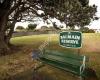 Balmain Park
7 km
Balmain Park
7 km
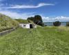 North Head Historic Reserve
7 km
Wow! We were so surprised by this place. The tunnels are amazing and the views around...
North Head Historic Reserve
7 km
Wow! We were so surprised by this place. The tunnels are amazing and the views around...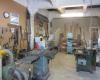 The Clay Store
7 km
Do you have a project you want to work on? Maybe you lack the tools or workspace to d...
The Clay Store
7 km
Do you have a project you want to work on? Maybe you lack the tools or workspace to d...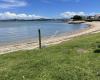 Torpedo Bay Wharf
7 km
Torpedo Bay Wharf
7 km
 Windsor Reserve
7 km
Took the ferry across to Devonport before Anzac Day and had a lovely lunch on the es...
Windsor Reserve
7 km
Took the ferry across to Devonport before Anzac Day and had a lovely lunch on the es...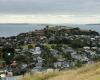 Mount Victoria
8 km
Mount Victoria
8 km
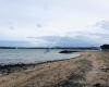
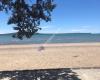 Kohimarama Beach
8 km
Love this stretch of beach. Far away from the main part of Mission bay. Great area fo...
Kohimarama Beach
8 km
Love this stretch of beach. Far away from the main part of Mission bay. Great area fo...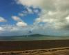 Takapuna Reef
8 km
Takapuna Reef
8 km
 Michael Joseph Savage Memorial Park
8 km
Located at the Bastion Point of the east Auckland near Mission Bay, Michael Joseph Sa...
Michael Joseph Savage Memorial Park
8 km
Located at the Bastion Point of the east Auckland near Mission Bay, Michael Joseph Sa...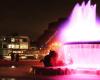 Selwyn Domain
8 km
Selwyn Reserve has established trees for shade, grassed areas for exercise, recently ...
Selwyn Domain
8 km
Selwyn Reserve has established trees for shade, grassed areas for exercise, recently ...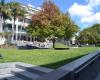 Hurstmere Green
8 km
Hurstmere Green
8 km
 Devonport
8 km
Devonport
8 km
to add Rangitoto Island map to your website;