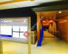
 High St at Toowong Village, stop 23
38 miles
High Street at Toowong Village Stop 23 is the Brisbane City Council Bus-stop for bus ... Benson House Car Park
65 miles
This is a Community Business Car Park for 2 Benson St Toowong 4066. Businesses at thi...
High St at Toowong Village, stop 23
38 miles
High Street at Toowong Village Stop 23 is the Brisbane City Council Bus-stop for bus ... Benson House Car Park
65 miles
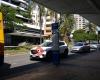
This is a Community Business Car Park for 2 Benson St Toowong 4066. Businesses at thi... Toowong Village Parking
68 miles
Worst car park I have ever used signage is terrible and there are kerbs protruding al... Wilson Parking - 31 High Street
95 miles
No casual parking available on the weekend, so I had to pay $5 for just 30 minutes. T... Sherwood Rd at Jephson St, stop 15/22
104 miles
Toowong Village Parking
68 miles
Worst car park I have ever used signage is terrible and there are kerbs protruding al... Wilson Parking - 31 High Street
95 miles
No casual parking available on the weekend, so I had to pay $5 for just 30 minutes. T... Sherwood Rd at Jephson St, stop 15/22
104 miles
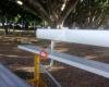
 Laugher Park
109 miles
Best park ever. Love kicking the footy around with my mates. 100 bucks if you hit the... Jephson St at Toowong
152 miles
Coronation Dr at Regatta
219 miles
Brisbane St at Kayes Rocks, stop 15
223 miles
Brisbane St at Kayes Rocks Stop 15, Toowong is a bus-stop for Brisbane City Council b... Ascog Tce near Jephson St, stop 16
225 miles
Laugher Park
109 miles
Best park ever. Love kicking the footy around with my mates. 100 bucks if you hit the... Jephson St at Toowong
152 miles
Coronation Dr at Regatta
219 miles
Brisbane St at Kayes Rocks, stop 15
223 miles
Brisbane St at Kayes Rocks Stop 15, Toowong is a bus-stop for Brisbane City Council b... Ascog Tce near Jephson St, stop 16
225 miles
 Regatta Ferry Terminal
270 miles
Finally, the regatta ferry terminal resume to travelers again after the devastating f... Jephson St near Ventnor St, stop 14
280 miles
Gailey Rd at Brisbane Street, stop 16
297 miles
Regatta Ferry Terminal
270 miles
Finally, the regatta ferry terminal resume to travelers again after the devastating f... Jephson St near Ventnor St, stop 14
280 miles
Gailey Rd at Brisbane Street, stop 16
297 miles
 Sylvan Rd at Bulldogs, stop 13
300 miles
Josling St near Herbert St, stop 16
302 miles
Sylvan Rd at Bulldogs, stop 13
300 miles
Josling St near Herbert St, stop 16
302 miles
to add Toowong station map to your website;

We use cookies and other tracking technologies to improve your browsing experience on our website, to show you personalized content and targeted ads, to analyze our website traffic, and to understand where our visitors are coming from. Privacy Policy