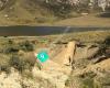
The Sugarloaf is a landmark in the Port Hills to the south of the city Christchurch. The Sugarloaf communications tower is an iconic radio and television transmission mast located on top of the hill.GeographyThe tower is situated at an elevation of 493.78 m on the top of the Port Hills, near Dyers Pass. This area is officially known as Sugarloaf Scenic Reserve. This reserve land occasionally doubles as a sheep farm and includes a car park lookout point for general public use.Communications towerIn 1966 the New Zealand Broadcasting Corporation leased a 4.9ha section of the reserve from the Crown on the summit of Sugarloaf Hill and installed the communications tower and control building. With a height of 121 m, the lattice steel structured tower is founded on a 5-metre deep concrete pad underlain by basalt volcanic rock. It is situated approximately 50 m behind the main transmission building, which combined with the tower is visible from most parts of Christchurch city.Visual appearanceAt a closer glance, the red and white tower includes an array of antennas including parabolic dishes, dipoles and microwave links. The tower has three main service decks for authorised technicians only with access ladders that run vertically along the eastern side. At night the tower is illuminated with three red beacons which span across the mast from top to bottom. On a clear night and viewed from the city you can often see the beacons and some fluorescent lighting coming from a room inside transmission house.Transmission houseThe tower is located 50 m behind a single storey transmission building which houses multiple transmission gear. The main equipment room is fully air conditioned and known to local technicians as the great transmitter hall. The building is approximately 40 m in width and 20 m in depth. On the roof of this building there are several satellites, small antennae and multiple parabolic dishes for private WiFi networks. There are two main shielded cable runs that go between the transmission house and back to the tower. This building has been unmanned for several years.
 Christchurch Gondola
5 km
Very fun. Once you get to the top you have a great view. The cold chocolates they ser...
Christchurch Gondola
5 km
Very fun. Once you get to the top you have a great view. The cold chocolates they ser... Wedding in the Park
7 km
Attended a school camp here. Great facilities and location. New toilet block was inst...
Wedding in the Park
7 km
Attended a school camp here. Great facilities and location. New toilet block was inst... Christchurch Botanic Gardens
8 km
A beautiful place. Visited from Auckland and spent a good few hours here, can’t beat ...
Christchurch Botanic Gardens
8 km
A beautiful place. Visited from Auckland and spent a good few hours here, can’t beat ... Hagley Oval
8 km
Hayley Park has always been a beautiful park. Whether walking alone or with my do...
Hagley Oval
8 km
Hayley Park has always been a beautiful park. Whether walking alone or with my do... New Brighton Beach
12 km
It’s nice beach but I was unlucky I couldn’t swim as the wind was it so strong. But i...
New Brighton Beach
12 km
It’s nice beach but I was unlucky I couldn’t swim as the wind was it so strong. But i... Denton Park Motel
12 km
We had a great stay at Denton Park. Very friendly and efficient staff. The rooms are ... Thomson Skate Park - TPUG
13 km
Thomson Park User's Group (T.P.U.G.) is a community group set up with the aim of keep...
Denton Park Motel
12 km
We had a great stay at Denton Park. Very friendly and efficient staff. The rooms are ... Thomson Skate Park - TPUG
13 km
Thomson Park User's Group (T.P.U.G.) is a community group set up with the aim of keep... Willowbank Wildlife Reserve
16 km
A great place to spend as long as you need to entertain the kids, and your own inner ... Spencer Beach Holiday Park
20 km
Wow, this place wasn't full, but it is a hugh place... some new facilities and worth ... Spencer Park
20 km
Wow, this place wasn't full, but it is a hugh place... some new facilities and worth ...
Willowbank Wildlife Reserve
16 km
A great place to spend as long as you need to entertain the kids, and your own inner ... Spencer Beach Holiday Park
20 km
Wow, this place wasn't full, but it is a hugh place... some new facilities and worth ... Spencer Park
20 km
Wow, this place wasn't full, but it is a hugh place... some new facilities and worth ... Hibburt Park
20 km
This page is your link to all things Hibburt Park, including: News, updates, fundrais... McLeans Island
21 km
Tongariro
556 km
Tongariro je v současnosti neaktivní stratovulkán, nacházející se na novozélandském S... 汤加里罗山
556 km
汤加里罗山(Mount Tongariro)也称东格里罗山,为新西兰北岛的一座活火山,位于陶波湖西南20公里处,海拔1978米,最近一次喷发发生在1977年。原为原住民领... Tongariro
556 km
Should get more stars but I was disappointed by the number of visitors when we hiked ... Tongariro
556 km
Tongariro este un vulcanvulcan de pe insula de nord a Noii Zeelande în Parcul Naționa... Tongariro
556 km
Tongariro är ett vulkaniskt bergsområde på Nordön i Nya Zeeland. Det ligger 20 kilome...
Hibburt Park
20 km
This page is your link to all things Hibburt Park, including: News, updates, fundrais... McLeans Island
21 km
Tongariro
556 km
Tongariro je v současnosti neaktivní stratovulkán, nacházející se na novozélandském S... 汤加里罗山
556 km
汤加里罗山(Mount Tongariro)也称东格里罗山,为新西兰北岛的一座活火山,位于陶波湖西南20公里处,海拔1978米,最近一次喷发发生在1977年。原为原住民领... Tongariro
556 km
Should get more stars but I was disappointed by the number of visitors when we hiked ... Tongariro
556 km
Tongariro este un vulcanvulcan de pe insula de nord a Noii Zeelande în Parcul Naționa... Tongariro
556 km
Tongariro är ett vulkaniskt bergsområde på Nordön i Nya Zeeland. Det ligger 20 kilome...to add Sugarloaf Transmitter map to your website;