Mangere Bridge, officially also called the Manukau Harbour Crossing, is a dual motorway bridge over the Manukau Harbour in south-western Auckland, New Zealand, crossing between the suburb also known as Mangere Bridge (southern side) and the suburb of Onehunga (northern side). Completed in 1983, the older portion of the bridge carries a four-lane motorway (carrying approximately 80,000 vehicles daily) with a cycle and pedestrian path also suspended underneath the western side of the bridge.In April 2008, work began on a duplication of the 1983 bridge to cater for increased traffic (completed in 2010), and to serve up to 160,000 vehicles per day in 2021. The process had been delayed by disagreements over design and funding, as well as over the scope of the bridge project and an associated interchange – with the interchange being scaled down after concerns from the local community.Original bridgesInitial bridge The initial bridge in this location was built of timber and opened in January 1875. Rather narrow, it also soon began to be attacked by shipworms, and in 1910, more than 30 of the piles had been replaced, as well as the decking. The bridge was also single-lane, and so narrow, even pedestrians could barely pass a vehicle safely. The bridge was eventually considered structurally unsound and closed in 1914, before being fully demolished.Old Mangere Bridge In January 1914 (some sources, 1915), a 246 m long replacement bridge was opened. Designed by R.F. Moore, the designer of Grafton Bridge, it was also built by the same company, the Ferro-Concrete Company of Australasia (in a time when almost all bridges in the country were being built by the Public Works Department). This ferro-concrete bridge with driven concrete piles was considered a substantial engineering achievement in its time. With a width of 11.6m, it allowed for a double tram track. The bridge however did not provide for enough clearance to let anything but small boats pass under it. In World War II, an anti-tank road block was erected on the bridge near the middle of the spans, with a small sentry shelter close by. These structures were later removed, and it is unclear whether the bridge had also been mined.
 Mangere Bridge, New Zealand
904 meter
Mangere Bridge is an Auckland suburb under the local governance of the Auckland Counc...
Mangere Bridge, New Zealand
904 meter
Mangere Bridge is an Auckland suburb under the local governance of the Auckland Counc... Onehunga
2 km
Discover Onehunga: Our exciting town centre always has lots going on with great cafes... Te Papapa
2 km
Te Papapa is a suburb of Auckland, New Zealand. It is located nine kilometres to the ... Royal Oak, New Zealand
3 km
Royal Oak is a small suburb in New Zealand's largest city of Auckland. It is situated... Hillsborough, Auckland
3 km
Hillsborough is an Auckland, New Zealand suburb.Hillsborough is under the local gover... One Tree Hill (New Zealand)
4 km
Cornwall Park is such a gorgeous place to visit. Lots of different walks for people o... Mangere East, New Zealand
4 km
Māngere is one of the largest suburbs in Auckland, in northern New Zealand. It is loc... Ellerslie, New Zealand
4 km
Ellerslie is a suburb of the city of Auckland, on the North Island of New Zealand. It... Greenlane
5 km
Greenlane is a suburb of Auckland, New Zealand.The Greenlane shops are the main shopp...
Onehunga
2 km
Discover Onehunga: Our exciting town centre always has lots going on with great cafes... Te Papapa
2 km
Te Papapa is a suburb of Auckland, New Zealand. It is located nine kilometres to the ... Royal Oak, New Zealand
3 km
Royal Oak is a small suburb in New Zealand's largest city of Auckland. It is situated... Hillsborough, Auckland
3 km
Hillsborough is an Auckland, New Zealand suburb.Hillsborough is under the local gover... One Tree Hill (New Zealand)
4 km
Cornwall Park is such a gorgeous place to visit. Lots of different walks for people o... Mangere East, New Zealand
4 km
Māngere is one of the largest suburbs in Auckland, in northern New Zealand. It is loc... Ellerslie, New Zealand
4 km
Ellerslie is a suburb of the city of Auckland, on the North Island of New Zealand. It... Greenlane
5 km
Greenlane is a suburb of Auckland, New Zealand.The Greenlane shops are the main shopp...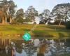 Akarana Golf Club
5 km
Very well kept course, water, fountains, tiered greens. Really well presented especia... Mount Roskill
5 km
Mount Roskill is both a volcanic peak and the suburban area in the city of Auckland, ...
Akarana Golf Club
5 km
Very well kept course, water, fountains, tiered greens. Really well presented especia... Mount Roskill
5 km
Mount Roskill is both a volcanic peak and the suburban area in the city of Auckland, ...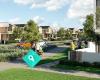 McLennan
5 km
McLennan is a new community-focused development in the heart of Papakura and Takanini... Remuera
6 km
Remuera is an affluent inner city residential suburban area within Auckland, in the N... Sandringham, New Zealand
6 km
Sandringham is a suburb of Auckland, New Zealand. It is a bustling, multi-ethnic subu...
McLennan
5 km
McLennan is a new community-focused development in the heart of Papakura and Takanini... Remuera
6 km
Remuera is an affluent inner city residential suburban area within Auckland, in the N... Sandringham, New Zealand
6 km
Sandringham is a suburb of Auckland, New Zealand. It is a bustling, multi-ethnic subu... Sandringham Village
6 km
Sandringham Village is a vibrant multi-cultural community. Enjoy the forum for local ...
Sandringham Village
6 km
Sandringham Village is a vibrant multi-cultural community. Enjoy the forum for local ...to add Mangere Bridge map to your website;