Link Church is located right in the centre of Lower Hutt. We're passionate about seeing this valley saturated in the love and hope of Jesus!
Follow us on Twitter @linkhuttcity
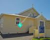 Our Lady Of the Rosary, Waiwhetu
1 km
Our church- what can I say it's the centre of our local catholic community. Services ...
Our Lady Of the Rosary, Waiwhetu
1 km
Our church- what can I say it's the centre of our local catholic community. Services ... NZ Columbans
2 km
NZ Columbans
2 km
 Wellington Tongan Assembly of God
3 km
Our faith is grounded in the message of the cross 1Corithian 1:18 St Bernadette's Catholic Church
4 km
What a wonderfully inviting group of people at St Bernadette's! I'd never been there ...
Wellington Tongan Assembly of God
3 km
Our faith is grounded in the message of the cross 1Corithian 1:18 St Bernadette's Catholic Church
4 km
What a wonderfully inviting group of people at St Bernadette's! I'd never been there ... ENABLE Tamil Christian Fellowship, Lower Hut...
4 km
Spirit filled believers worshiping the Lord Jesus Christ in Tamil Language in Lower H...
ENABLE Tamil Christian Fellowship, Lower Hut...
4 km
Spirit filled believers worshiping the Lord Jesus Christ in Tamil Language in Lower H... St Mary and St. Mina’s Coptic Orthodox Catho...
4 km
Great place. From experience I love this church, great people, the priest is nice and... Life City Church
5 km
Hosanna World Outreach Centre
5 km
For the first time in my life I'm excepted for who I am, There are beautiful Brothers... EFKS Hutt Valley
5 km
St Mary and St. Mina’s Coptic Orthodox Catho...
4 km
Great place. From experience I love this church, great people, the priest is nice and... Life City Church
5 km
Hosanna World Outreach Centre
5 km
For the first time in my life I'm excepted for who I am, There are beautiful Brothers... EFKS Hutt Valley
5 km
 Hills NZ
6 km
It's a ok school, I'm on my 12th year of schooling, if you want to have a good chemis... St Patrick's
7 km
We're visiting our daughter in Wellington for the Christmas holidays of 2025, and thi...
Hills NZ
6 km
It's a ok school, I'm on my 12th year of schooling, if you want to have a good chemis... St Patrick's
7 km
We're visiting our daughter in Wellington for the Christmas holidays of 2025, and thi... HCUC - St Stephen's Wainuiomata Union Church
8 km
nice small church great for little events . Has a separate hall attached for gatherin...
HCUC - St Stephen's Wainuiomata Union Church
8 km
nice small church great for little events . Has a separate hall attached for gatherin... St Ronan's Presbyterian Church
9 km
Friendly, inviting, down to earth folks. Sunday schoolPower Hour is consistently abso...
St Ronan's Presbyterian Church
9 km
Friendly, inviting, down to earth folks. Sunday schoolPower Hour is consistently abso...to add Link Church map to your website;